 vesseltracker.com
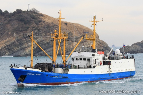
Vessel Ostrov Iony IMO: 8847052, MMSI: 273873500 Fish Carrier
UTC, 45.14465, 136.96751, course: 218, speed: 8.7
UTC, 45.14465, 136.96751, course: 218, speed: 8.7
2026-03-12 18:17:04 UTC, 44.24870, 135.95035, course: 219, speed: 8.9
Live Vessel Ostrov Iony Analytics (details, animations, etc.)
Live AIS position: UTC. 33 nm SW of PLASTUN), updated 2026-03-12 18:17:04 UTC.Find the position of the vessel Ostrov Iony on the map. The latter are known coordinates and path.
marine traffic ship tracker show on live map
The current position of vessel Ostrov Iony is 44.24870 lat / 135.95035 lng. Updated: 2026-03-12 18:17:04 UTCDetails:
Last coordinates of the vessel:
UTC, 45.14465, 136.96751, course: 218, speed: 8.7UTC, 45.14465, 136.96751, course: 218, speed: 8.7
UTC, 45.14465, 136.96751, course: 218, speed: 8.7
2026-03-12 18:17:04 UTC, 44.24870, 135.95035, course: 219, speed: 8.9