 vesseltracker.com
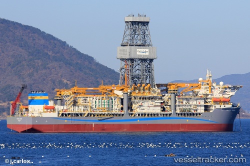
Vessel PACIFIC ZONDA IMO: 9685176, MMSI: 538010050 Drilling Ship
Live AIS position:
UTC. 30 nm SW of Erawan),
updated 2025-12-25 16:28:21 UTC.
Find the position of the vessel PACIFIC ZONDA on the map. The latter are known coordinates and path.
marine traffic ship tracker show on live map
The current position of vessel PACIFIC ZONDA is 8.69647 lat / 101.06065 lng. Updated: 2025-12-25 16:28:21 UTCCurrently sailing under the flag of Marshall Islands
PACIFIC ZONDA built in 2023 year
Deadweight:
58183 tDetails:
Last coordinates of the vessel:
2025-12-25 16:28:21 UTC, 8.69647, 101.06065, course: 148, speed: 68.7