 vesseltracker.com
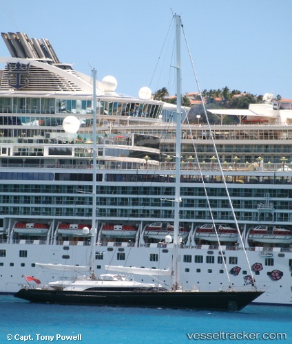
Vessel PANTHALASSEA IMO: 9578103, MMSI: 229905000 Houseboat
UTC, 18.38444, -64.70842, course: 77, speed: 0
UTC, 18.35747, -64.58724, course: 97, speed: 0.5
2026-01-28 16:22:32 UTC, 18.35780, -64.58730, course: 237, speed: 0.1
Live AIS position:
UTC. Near NORMAN ISLAND),
updated 2026-01-28 16:22:32 UTC.
Find the position of the vessel PANTHALASSEA on the map. The latter are known coordinates and path.
marine traffic ship tracker show on live map
The current position of vessel PANTHALASSEA is 18.35780 lat / -64.58730 lng. Updated: 2026-01-28 16:22:32 UTCCurrently sailing under the flag of Malta
PANTHALASSEA built in 2010 year
Deadweight:
82 tDetails:
Last coordinates of the vessel:
UTC, 18.34775, -64.63135, course: 311, speed: 7.6UTC, 18.38444, -64.70842, course: 77, speed: 0
UTC, 18.35747, -64.58724, course: 97, speed: 0.5
2026-01-28 16:22:32 UTC, 18.35780, -64.58730, course: 237, speed: 0.1