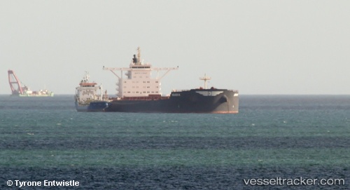
vessel PAROS IMO: 9469675, Bulk Carrier vesseltracker.com
Vessel PAROS IMO: 9469675, Bulk Carrier
MMSI: 256087000 callsign: 9HA5688 size: 45x292

Find the position of the vessel PAROS on the map. The latter are known coordinates and path.

marine traffic ship tracker show on live map

The current position of vessel PAROS is 21.14347 lat / 38.14342 lng. Updated: 2023-03-26 21:07:30 UTC

Currently sailing under the flag of Malta

PAROS built in 2010 year

Deadweight:
182060 t

Details:


Last coordinates of the vessel:
2023-03-26 21:07:30 UTC, 21.14347, 38.14342, course: 151, speed: 11.5

Track of the vessel in the last 14 days


Most frequent ports a vessels calls at PAROS (256087000):

Yeosu, traffic: 2
Yosu, traffic: 2
Gladstone Harbor, traffic: 2
Port Hedland, traffic: 1
Sambu, traffic: 1
Selat Lombok, traffic: 1
Singapore, traffic: 1
Wu-Sung, traffic: 1
Wusong, traffic: 1
Port Headland, traffic: 1
Lianyungang, traffic: 1
Paradip, traffic: 1

Link to the map:


Find another ship

PAROS (256087000) last ports (portcalls and passsages)

Yosu | 2022-08-03 04:20:54
Yosu | 2022-07-30 04:14:21
Wusong | 2022-07-24 13:28:21
Lianyungang | 2022-07-20 04:05:34
Port Headland | 2022-07-04 13:23:56
Selat Lombok | 2022-07-01 10:33:22
Singapore | 2022-06-04 01:18:01
Paradip | 2022-03-01 21:05:10
Gladstone Harbor | 2022-01-26 19:37:03