 vesseltracker.com
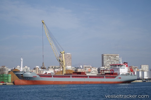
Vessel POLARNET IMO: 9758961, MMSI: 271044519 General Cargo Ship
UTC, 38.81668, 26.94396, course: 25, speed: 0
UTC, 38.81674, 26.94386, course: 89, speed: 0
UTC, 38.81674, 26.94386, course: 89, speed: 0
2026-02-05 01:43:36 UTC, 38.81674, 26.94386, course: 89, speed: 0
Live AIS position:
UTC. Near Aliaga),
updated 2026-02-05 01:43:36 UTC.
Find the position of the vessel POLARNET on the map. The latter are known coordinates and path.
marine traffic ship tracker show on live map
The current position of vessel POLARNET is 38.81674 lat / 26.94386 lng. Updated: 2026-02-05 01:43:36 UTCCurrently sailing under the flag of Turkey
POLARNET built in 2016 year
Deadweight:
12242 tDetails:
Last coordinates of the vessel:
UTC, 38.81668, 26.94396, course: 25, speed: 0UTC, 38.81668, 26.94396, course: 25, speed: 0
UTC, 38.81674, 26.94386, course: 89, speed: 0
UTC, 38.81674, 26.94386, course: 89, speed: 0
2026-02-05 01:43:36 UTC, 38.81674, 26.94386, course: 89, speed: 0