 vesseltracker.com
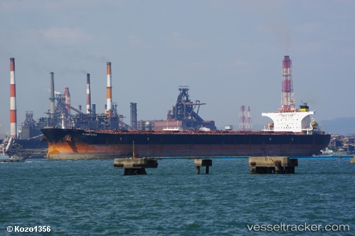
Vessel POMPANO IMO: 9346768, MMSI: 636022205 Bulk Carrier
UTC, -9.71365, -2.14663, course: 143, speed: 9.6
UTC, -9.96997, -1.97018, course: 142, speed: 9.4
2026-02-13 19:52:24 UTC, -10.23207, -1.74353, course: 139, speed: 9.6
Live AIS position:
UTC. 374 nm NE of Levelwood),
updated 2026-02-13 19:52:24 UTC.
Find the position of the vessel POMPANO on the map. The latter are known coordinates and path.
marine traffic ship tracker show on live map
The current position of vessel POMPANO is -10.23207 lat / -1.74353 lng. Updated: 2026-02-13 19:52:24 UTCCurrently sailing under the flag of Liberia
POMPANO built in 2006 year
Deadweight:
174219 tDetails:
Last coordinates of the vessel:
UTC, -9.39317, -2.37375, course: 141, speed: 9.8UTC, -9.71365, -2.14663, course: 143, speed: 9.6
UTC, -9.96997, -1.97018, course: 142, speed: 9.4
2026-02-13 19:52:24 UTC, -10.23207, -1.74353, course: 139, speed: 9.6