vessel PROODOS IMO: 9290921, Chemical/Oil Products Tanker vesseltracker.com
Vessel PROODOS IMO: 9290921, Chemical/Oil Products Tanker
MMSI: 538009836 callsign: V7A5235 size: 32x183

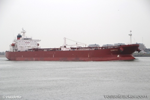
Find the position of the vessel PROODOS on the map. The latter are known coordinates and path.

marine traffic ship tracker show on live map

The current position of vessel PROODOS is -49.87077331542969 lat / 112.79010772705078 lng. Updated: 2025-08-10 22:30:35 UTC

Currently sailing under the flag of Marshall Islands

PROODOS built in 2005 year

Deadweight:
47120 t

Details:


Last coordinates of the vessel:
2025-08-10 22:30:35 UTC, -49.87077331542969, 112.79010772705078, course: 0, speed: 5

Track of the vessel in the last 14 days


Most frequent ports a vessels calls at PROODOS (538009836):

Las Palmas, traffic: 4
Flushing, traffic: 4
Puerto De La Luz, traffic: 4
Terneuzen, traffic: 4
Vlissingen, traffic: 4
Zeebrugge, traffic: 2
Antwerp, traffic: 2
Apapa, traffic: 2
Brixham, traffic: 2
Paranagua, traffic: 2
Conakry, traffic: 2
Dover, traffic: 2
Freetown, traffic: 2
Strait Of Gibraltar, traffic: 2
Algeciras, traffic: 1

Link to the map:


Find another ship

PROODOS (538009836) last ports (portcalls and passsages)

TABOGA | 2024-11-14 05:48:01
Bayuquan | 2024-08-08 10:24:27
Port Swettenham | 2023-06-07 16:20:55
Maassluis | 2023-02-21 23:41:45
Paranagua | 2023-01-29 02:47:50
Paranagua | 2023-01-25 00:02:37
Lome | 2023-01-11 08:05:59
Apapa | 2023-01-07 11:45:13
Lagos | 2023-01-03 11:02:37
Hong Kong | 2022-08-12 07:42:25
Algeciras | 2022-01-12 05:10:18
Strait Of Gibraltar | 2022-01-12 00:50:49
Puerto De La Luz | 2022-01-09 13:25:07
Conakry | 2021-12-22 08:07:51
Freetown | 2021-12-18 15:21:07
Las Palmas | 2021-12-14 03:40:13
Brixham | 2021-12-09 05:16:25
Dover | 2021-12-08 10:40:57
Flushing | 2021-12-08 00:54:19
Terneuzen | 2021-12-07 23:57:41
Antwerp | 2021-12-01 12:38:19
Terneuzen | 2021-12-01 08:19:42
Flushing | 2021-12-01 07:52:40
Zeebrugge | 2021-12-01 04:52:03