 vesseltracker.com
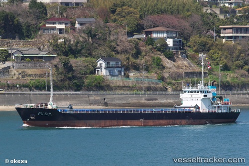
Vessel PU DUN IMO: 9083639, MMSI: 677048900 General Cargo Ship
UTC, 19.72833, 113.77500, course: -1, speed: 2
UTC, 19.71500, 113.75833, course: -1, speed: 2
2026-02-04 10:04:29 UTC, 19.60500, 113.63667, course: -1, speed: 2
Live AIS position:
UTC. 122 nm SW of Xijiang),
updated 2026-02-04 10:04:29 UTC.
Find the position of the vessel PU DUN on the map. The latter are known coordinates and path.
marine traffic ship tracker show on live map
The current position of vessel PU DUN is 19.60500 lat / 113.63667 lng. Updated: 2026-02-04 10:04:29 UTCCurrently sailing under the flag of Not Known
PU DUN built in 1994 year
Deadweight:
1291 tDetails:
Last coordinates of the vessel:
UTC, 19.87333, 113.97667, course: -1, speed: 3UTC, 19.72833, 113.77500, course: -1, speed: 2
UTC, 19.71500, 113.75833, course: -1, speed: 2
2026-02-04 10:04:29 UTC, 19.60500, 113.63667, course: -1, speed: 2