 vesseltracker.com
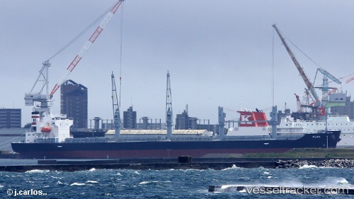
Vessel PUMA IMO: 9748265, MMSI: 319114200 Bulk Carrier
UTC, 40.37333, -14.36833, course: -1, speed: 7
UTC, 40.19500, -14.55833, course: -1, speed: 7
2026-02-04 21:41:07 UTC, 39.97833, -14.80333, course: -1, speed: 7
Live AIS position:
UTC. 170 nm W of Utiel),
updated 2026-02-04 21:41:07 UTC.
Find the position of the vessel PUMA on the map. The latter are known coordinates and path.
marine traffic ship tracker show on live map
The current position of vessel PUMA is 39.97833 lat / -14.80333 lng. Updated: 2026-02-04 21:41:07 UTCCurrently sailing under the flag of Cayman Islands
PUMA built in 2017 year
Deadweight:
34979 tDetails:
Last coordinates of the vessel:
UTC, 40.57272, -14.14916, course: 223, speed: 7.1UTC, 40.37333, -14.36833, course: -1, speed: 7
UTC, 40.19500, -14.55833, course: -1, speed: 7
2026-02-04 21:41:07 UTC, 39.97833, -14.80333, course: -1, speed: 7