 vesseltracker.com
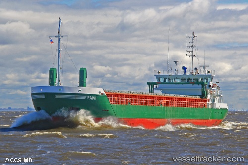
Vessel Paivi IMO: 9434149, MMSI: 212801000 General Cargo Ship
UTC, 44.50555, 12.32796, course: 348, speed: 0
UTC, 44.50566, 12.32816, course: 337, speed: 0
2026-02-01 02:15:10 UTC, 44.50566, 12.32823, course: 337, speed: 0
Live AIS position:
UTC. Near Marina di Ravenna),
updated 2026-02-01 02:15:10 UTC.
Find the position of the vessel Paivi on the map. The latter are known coordinates and path.
marine traffic ship tracker show on live map
The current position of vessel Paivi is 44.50566 lat / 12.32823 lng. Updated: 2026-02-01 02:15:10 UTCCurrently sailing under the flag of Cyprus
Paivi built in 2008 year
Deadweight:
3450 tDetails:
Last coordinates of the vessel:
UTC, 44.50560, 12.32817, course: 335, speed: 0UTC, 44.50555, 12.32796, course: 348, speed: 0
UTC, 44.50566, 12.32816, course: 337, speed: 0
2026-02-01 02:15:10 UTC, 44.50566, 12.32823, course: 337, speed: 0