 vesseltracker.com
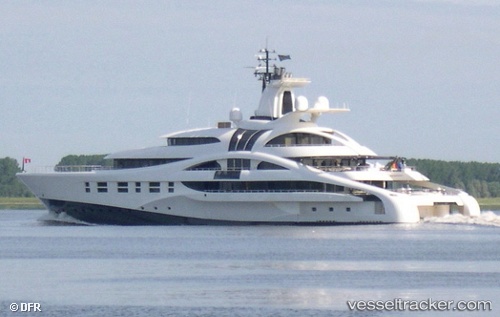
Vessel PALLADIUM IMO: 1010167, MMSI: 319030100 Houseboat
UTC, 22.88946, -109.89510, course: 33, speed: 0
UTC, 22.88954, -109.89496, course: 10, speed: 0
2026-01-31 09:24:20 UTC, 22.88952, -109.89473, course: 342, speed: 3.2
Live AIS position:
UTC. Near Cabo San Lucas),
updated 2026-01-31 09:24:20 UTC.
Find the position of the vessel PALLADIUM on the map. The latter are known coordinates and path.
marine traffic ship tracker show on live map
The current position of vessel PALLADIUM is 22.88952 lat / -109.89473 lng. Updated: 2026-01-31 09:24:20 UTCCurrently sailing under the flag of Cayman Islands
PALLADIUM built in 2010 year
Deadweight:
565 tDetails:
Last coordinates of the vessel:
UTC, 22.88953, -109.89507, course: 39, speed: 0UTC, 22.88946, -109.89510, course: 33, speed: 0
UTC, 22.88954, -109.89496, course: 10, speed: 0
2026-01-31 09:24:20 UTC, 22.88952, -109.89473, course: 342, speed: 3.2