 vesseltracker.com
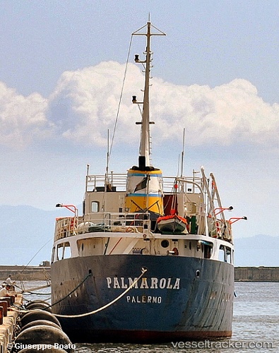
Vessel Palmarola IMO: 5359951, MMSI: 247223500 Water Tanker
UTC, 41.23615, 13.57432, course: -1, speed: 0
UTC, 41.23612, 13.57427, course: -1, speed: 0.1
2026-02-01 15:31:56 UTC, 41.23612, 13.57425, course: -1, speed: 0
Live AIS position:
UTC. Near Gaeta),
updated 2026-02-01 15:31:56 UTC.
Find the position of the vessel Palmarola on the map. The latter are known coordinates and path.
marine traffic ship tracker show on live map
The current position of vessel Palmarola is 41.23612 lat / 13.57425 lng. Updated: 2026-02-01 15:31:56 UTCCurrently sailing under the flag of Italy
Palmarola built in 1962 year
Deadweight:
899 tDetails:
Last coordinates of the vessel:
UTC, 41.23612, 13.57428, course: -1, speed: 0UTC, 41.23615, 13.57432, course: -1, speed: 0
UTC, 41.23612, 13.57427, course: -1, speed: 0.1
2026-02-01 15:31:56 UTC, 41.23612, 13.57425, course: -1, speed: 0