 vesseltracker.com
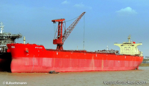
Vessel Pan Hope IMO: 9468724, MMSI: 370137000 Bulk Carrier
UTC, 5.10708, 106.76012, course: 225, speed: 12.1
UTC, 4.78574, 106.43787, course: 225, speed: 12.3
2026-01-30 03:26:30 UTC, 4.56563, 106.20561, course: 224, speed: 12.4
Live AIS position:
UTC. 24 nm N of Belanak Terminal),
updated 2026-01-30 03:26:30 UTC.
Find the position of the vessel Pan Hope on the map. The latter are known coordinates and path.
marine traffic ship tracker show on live map
The current position of vessel Pan Hope is 4.56563 lat / 106.20561 lng. Updated: 2026-01-30 03:26:30 UTCDetails:
Last coordinates of the vessel:
UTC, 5.44660, 107.09752, course: 228, speed: 12.1UTC, 5.10708, 106.76012, course: 225, speed: 12.1
UTC, 4.78574, 106.43787, course: 225, speed: 12.3
2026-01-30 03:26:30 UTC, 4.56563, 106.20561, course: 224, speed: 12.4