 vesseltracker.com
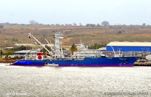
Vessel Panama Tuna IMO: 9175028, MMSI: 735058003 Fishing Vessel
UTC, -2.69652, -80.24593, course: 332, speed: 0
UTC, -2.69654, -80.24591, course: 332, speed: 0
2026-01-30 00:18:37 UTC, -2.69660, -80.24585, course: 331, speed: 0
Live AIS position:
UTC. Near POSORJA),
updated 2026-01-30 00:18:37 UTC.
Find the position of the vessel Panama Tuna on the map. The latter are known coordinates and path.
marine traffic ship tracker show on live map
The current position of vessel Panama Tuna is -2.69660 lat / -80.24585 lng. Updated: 2026-01-30 00:18:37 UTCDetails:
Last coordinates of the vessel:
UTC, -2.69657, -80.24587, course: 332, speed: 0UTC, -2.69652, -80.24593, course: 332, speed: 0
UTC, -2.69654, -80.24591, course: 332, speed: 0
2026-01-30 00:18:37 UTC, -2.69660, -80.24585, course: 331, speed: 0