 vesseltracker.com
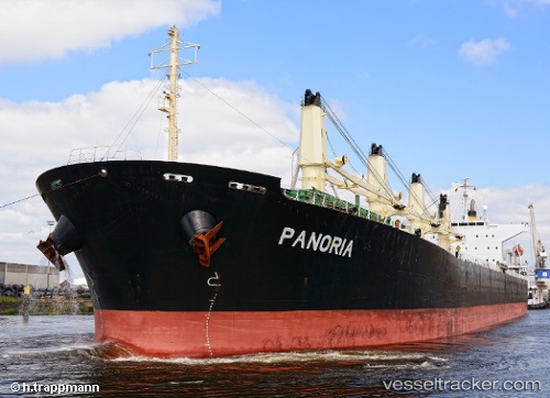
Vessel Panoria IMO: 9480930, MMSI: 538008112 Bulk Carrier
UTC, 11.02300, -38.62788, course: 57, speed: 11.2
UTC, 11.27330, -38.29087, course: 53, speed: 11
2026-01-28 13:43:52 UTC, 11.48040, -38.00798, course: 54, speed: 10.9
Live AIS position:
UTC. 299 nm N of Parelhas),
updated 2026-01-28 13:43:52 UTC.
Find the position of the vessel Panoria on the map. The latter are known coordinates and path.
marine traffic ship tracker show on live map
The current position of vessel Panoria is 11.48040 lat / -38.00798 lng. Updated: 2026-01-28 13:43:52 UTCCurrently sailing under the flag of Marshall Is
Panoria built in 2008 year
Deadweight:
53514 tDetails:
Last coordinates of the vessel:
UTC, 10.81802, -38.90725, course: 52, speed: 10.8UTC, 11.02300, -38.62788, course: 57, speed: 11.2
UTC, 11.27330, -38.29087, course: 53, speed: 11
2026-01-28 13:43:52 UTC, 11.48040, -38.00798, course: 54, speed: 10.9