 vesseltracker.com
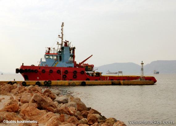
Vessel Pantanassa IMO: 9332561, MMSI: 241442000 Offshore Tug Supply Ship
UTC, 37.95871, 23.61313, course: -1, speed: 0
UTC, 37.95871, 23.61313, course: -1, speed: 0
2026-01-28 14:30:35 UTC, 37.95871, 23.61312, course: -1, speed: 0
Live AIS position:
UTC. Near Keratsini),
updated 2026-01-28 14:30:35 UTC.
Find the position of the vessel Pantanassa on the map. The latter are known coordinates and path.
marine traffic ship tracker show on live map
The current position of vessel Pantanassa is 37.95871 lat / 23.61312 lng. Updated: 2026-01-28 14:30:35 UTCCurrently sailing under the flag of Greece
Pantanassa built in 2005 year
Deadweight:
10 tDetails:
Last coordinates of the vessel:
UTC, 37.95833, 23.61167, course: -1, speed: 0UTC, 37.95871, 23.61313, course: -1, speed: 0
UTC, 37.95871, 23.61313, course: -1, speed: 0
2026-01-28 14:30:35 UTC, 37.95871, 23.61312, course: -1, speed: 0