 vesseltracker.com
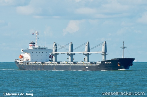
Vessel Papua IMO: 9266906, MMSI: 319122500 Bulk Carrier
Live AIS position:
UTC. Near SVETLY),
updated 2024-08-14 11:10:50 UTC.
Find the position of the vessel Papua on the map. The latter are known coordinates and path.
marine traffic ship tracker show on live map
The current position of vessel Papua is 54.68921 lat / 20.20328 lng. Updated: 2024-08-14 11:10:50 UTCCurrently sailing under the flag of Cayman Is
Papua built in 2003 year
Deadweight:
31817 tDetails:
Last coordinates of the vessel:
2024-08-14 11:10:50 UTC, 54.68921, 20.20328, course: 323, speed: 0