 vesseltracker.com
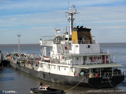
Vessel Paranai IMO: 8002286, MMSI: 701090000 Oil Products Tanker
2026-01-28 11:53:22 UTC, -34.84943, -57.89725, course: -1, speed: 0
Live AIS position:
UTC. Near Ensenada),
updated 2026-01-28 11:53:22 UTC.
Find the position of the vessel Paranai on the map. The latter are known coordinates and path.
marine traffic ship tracker show on live map
The current position of vessel Paranai is -34.84943 lat / -57.89725 lng. Updated: 2026-01-28 11:53:22 UTCDetails:
Last coordinates of the vessel:
UTC, -34.84944, -57.89727, course: -1, speed: 02026-01-28 11:53:22 UTC, -34.84943, -57.89725, course: -1, speed: 0