 vesseltracker.com
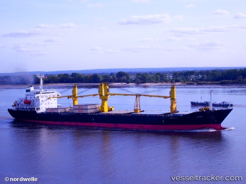
Vessel Parnia IMO: 9167265, MMSI: 422035900 General Cargo Ship
UTC, -4.01566, 40.12546, course: 142, speed: 1
UTC, -4.05964, 40.07532, course: 137, speed: 0.5
UTC, -4.07157, 40.05804, course: 131, speed: 0.6
UTC, -4.08482, 40.03932, course: 133, speed: 0.7
2026-01-24 03:53:18 UTC, -4.10035, 40.02922, course: 133, speed: 0.8
Live AIS position:
UTC. 21 nm E of Mombasa),
updated 2026-01-24 03:53:18 UTC.
Find the position of the vessel Parnia on the map. The latter are known coordinates and path.
marine traffic ship tracker show on live map
The current position of vessel Parnia is -4.10035 lat / 40.02922 lng. Updated: 2026-01-24 03:53:18 UTCDetails:
Last coordinates of the vessel:
UTC, -3.97323, 40.15325, course: 130, speed: 1.1UTC, -4.01566, 40.12546, course: 142, speed: 1
UTC, -4.05964, 40.07532, course: 137, speed: 0.5
UTC, -4.07157, 40.05804, course: 131, speed: 0.6
UTC, -4.08482, 40.03932, course: 133, speed: 0.7
2026-01-24 03:53:18 UTC, -4.10035, 40.02922, course: 133, speed: 0.8