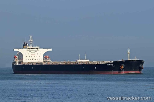
vessel Partagas IMO: 9272345, Bulk Carrier
vesseltracker.com
Vessel Partagas IMO: 9272345, Bulk Carrier
MMSI: 249953000 callsign: 9HA2095 size: 45x289

Find the position of the vessel Partagas on the map. The latter are known coordinates and path.

marine traffic ship tracker show on live map

The current position of vessel Partagas is 39.97572 lat / 119.82903 lng. Updated: 2022-09-23 03:22:41 UTC
Details:


Last coordinates of the vessel:
2022-09-23 03:22:41 UTC, 39.97572, 119.82903, course: 61, speed: 0

Track of the vessel in the last 14 days


Most frequent ports a vessels calls at Partagas (249953000):

Sambu, traffic: 8
Istanbul, traffic: 6
Bur Ibrahim, traffic: 6
Canakkale, traffic: 4
Gelibolu, traffic: 4
Uskudar, traffic: 4
Port Said, traffic: 4
Singapore, traffic: 4
Sitrah Anchorage, traffic: 2
Vishakhapatnam, traffic: 2
Paradip, traffic: 2
Ras Gharib, traffic: 2
Ra’S Shukhayr, traffic: 2
Ayn Sukhnah, traffic: 2
Kali Limenes, traffic: 1

Link to the map:


Find another ship

Partagas (249953000) last ports (portcalls and passsages)

Port Louis | 2022-07-04 04:14:54
Kali Limenes | 2022-04-04 12:31:15
Bur Ibrahim | 2022-04-02 08:59:39
Sitrah Anchorage | 2022-03-13 12:40:41
Paradip | 2022-02-27 06:05:32
Vishakhapatnam | 2022-02-22 09:04:26
Singapore | 2022-02-15 07:00:53
Sambu | 2022-01-12 04:20:03
Singapore | 2022-01-12 03:50:39
Sambu | 2022-01-12 03:40:12
Ra’S Shukhayr | 2021-12-24 03:51:00
Ras Gharib | 2021-12-24 02:05:09
Ayn Sukhnah | 2021-12-23 19:10:03
Bur Ibrahim | 2021-12-23 16:22:37
Port Said | 2021-12-23 06:05:19
Canakkale | 2021-12-20 10:05:03
Gelibolu | 2021-12-20 08:05:54
Istanbul | 2021-12-19 11:50:04
Uskudar | 2021-12-19 11:45:21
Uskudar | 2021-12-10 12:40:16
Gelibolu | 2021-12-09 04:57:16
Canakkale | 2021-12-09 03:10:17
Port Said | 2021-12-06 16:25:08
Bur Ibrahim | 2021-12-06 07:00:07