vessel VIKING PASSAMA IMO: 9491874, Vehicles Carrier vesseltracker.com
Vessel VIKING PASSAMA IMO: 9491874, Vehicles Carrier
MMSI: 538009816 callsign: V7A5204 size: x

Find the position of the vessel VIKING PASSAMA on the map. The latter are known coordinates and path.

marine traffic ship tracker show on live map

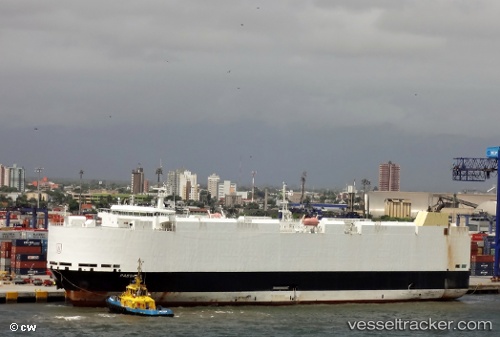
The current position of vessel VIKING PASSAMA is -37.1805 lat / 177.815 lng. Updated: 2024-04-23 17:15:39 UTC

Currently sailing under the flag of Marshall Islands

VIKING PASSAMA built in 2012 year

Port of registry:
Gibraltar (British Overseas Territory)
Deadweight:
12806 t

Payload_mass:
12805.91 tonne
Gross tonnage:
47053
Service entry:
2012-01-01T00:00:00Z
Details:


Last coordinates of the vessel:
UTC, -36.8605, 176.857, course: 115, speed: 15.1
UTC, -37.0371, 177.385, course: 114, speed: 15
UTC, -37.1022, 177.58, course: 115, speed: 14.8
2024-04-23 17:15:39 UTC, -37.1805, 177.815, course: 114, speed: 14.6

Track of the vessel in the last 14 days


Most frequent ports a vessels calls at VIKING PASSAMA (538009816):

Shimonoseki, traffic: 6
Kokura, traffic: 4
Yokohama, traffic: 4
Yokosuka, traffic: 4
Kawasaki, traffic: 4
Auckland, traffic: 3
Yokkaichi, traffic: 2
Lyttelton, traffic: 2
Mogpo, traffic: 2
Mokpo, traffic: 2
Nagoya, traffic: 2
Suva, traffic: 2
Ube, traffic: 2
Ulsan, traffic: 2
Wakamatsu, traffic: 2

Link to the map:


Find another ship

VIKING_PASSAMA (538009816) last ports (portcalls and passsages)

Auckland | 2022-01-19 00:05:08
Suva | 2022-01-14 18:56:22
Yokosuka | 2022-01-04 07:55:54
Yokohama | 2022-01-04 07:45:56
Yokohama | 2022-01-03 22:20:17
Kawasaki | 2022-01-03 22:15:08
Yokosuka | 2022-01-03 21:30:37
Yokkaichi | 2022-01-03 08:40:05
Nagoya | 2022-01-03 00:20:05
Ube | 2021-12-31 03:00:01
Shimonoseki | 2021-12-31 02:35:05
Shimonoseki | 2021-12-31 02:00:03
Kokura | 2021-12-31 01:25:04
Ulsan | 2021-12-30 02:42:17
Mokpo | 2021-12-29 05:19:30
Lyttelton | 2021-12-09 01:29:21
Wellington | 2021-12-05 21:21:53
Auckland | 2021-12-02 17:50:08