 vesseltracker.com
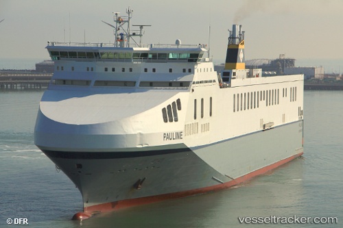
Vessel Pauline IMO: 9324473, MMSI: 249600000 Ro Ro Cargo Ship
UTC, 53.66964, -0.23554, course: 324, speed: 0.1
UTC, 53.66965, -0.23554, course: 324, speed: 0
2026-01-31 17:47:55 UTC, 53.66965, -0.23553, course: 324, speed: 0
Live AIS position:
UTC. Near North Killingholme),
updated 2026-01-31 17:47:55 UTC.
Find the position of the vessel Pauline on the map. The latter are known coordinates and path.
marine traffic ship tracker show on live map
The current position of vessel Pauline is 53.66965 lat / -0.23553 lng. Updated: 2026-01-31 17:47:55 UTCCurrently sailing under the flag of Malta
Pauline built in 2006 year
Deadweight:
17023 tDetails:
Last coordinates of the vessel:
UTC, 53.66986, -0.23605, course: 323, speed: 0.8UTC, 53.66964, -0.23554, course: 324, speed: 0.1
UTC, 53.66965, -0.23554, course: 324, speed: 0
2026-01-31 17:47:55 UTC, 53.66965, -0.23553, course: 324, speed: 0