 vesseltracker.com
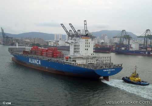
Vessel Pedro Alvares Cabral IMO: 9603219, MMSI: 710000646 Container Ship
UTC, -23.92099, -46.35127, course: 101, speed: 0
UTC, -24.07606, -46.27667, course: 115, speed: 13.5
2026-02-01 06:31:34 UTC, -23.99333, -45.58500, course: -1, speed: 13
Live AIS position:
UTC. 15 nm SW of Barrosso Terminal),
updated 2026-02-01 06:31:34 UTC.
Find the position of the vessel Pedro Alvares Cabral on the map. The latter are known coordinates and path.
marine traffic ship tracker show on live map
The current position of vessel Pedro Alvares Cabral is -23.99333 lat / -45.58500 lng. Updated: 2026-02-01 06:31:34 UTCCurrently sailing under the flag of Brazil
Pedro Alvares Cabral built in 2013 year
Deadweight:
52019 tDetails:
Last coordinates of the vessel:
UTC, -23.92101, -46.35129, course: 101, speed: 0UTC, -23.92099, -46.35127, course: 101, speed: 0
UTC, -24.07606, -46.27667, course: 115, speed: 13.5
2026-02-01 06:31:34 UTC, -23.99333, -45.58500, course: -1, speed: 13