 vesseltracker.com
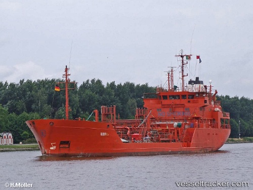
Vessel Peley IMO: 8513168, MMSI: 273356540 Chemical Oil Products Tanker
UTC, 52.41926, 156.25063, course: 100, speed: 0.1
UTC, 52.41959, 156.25172, course: 119, speed: 0.3
2026-01-30 07:35:09 UTC, 52.41984, 156.25288, course: 142, speed: 0.2
Live AIS position:
UTC. 56 nm N of Ozernovskiy),
updated 2026-01-30 07:35:09 UTC.
Find the position of the vessel Peley on the map. The latter are known coordinates and path.
marine traffic ship tracker show on live map
The current position of vessel Peley is 52.41984 lat / 156.25288 lng. Updated: 2026-01-30 07:35:09 UTCCurrently sailing under the flag of Russia
Peley built in 1986 year
Deadweight:
3284 tDetails:
Last coordinates of the vessel:
UTC, 52.41810, 156.25336, course: 359, speed: 0.1UTC, 52.41926, 156.25063, course: 100, speed: 0.1
UTC, 52.41959, 156.25172, course: 119, speed: 0.3
2026-01-30 07:35:09 UTC, 52.41984, 156.25288, course: 142, speed: 0.2