 vesseltracker.com
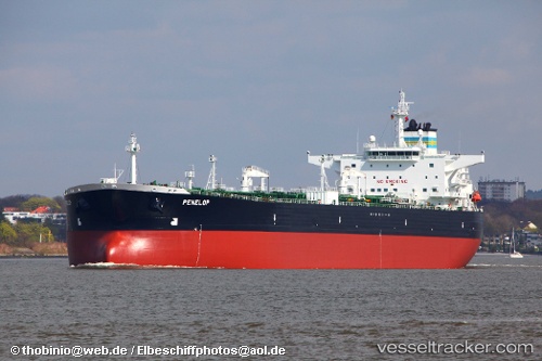
Vessel Penelop IMO: 9325908, MMSI: 309924000 Crude Oil Tanker
UTC, 53.75905, 0.42682, course: 116, speed: 0.8
UTC, 53.75889, 0.42664, course: 113, speed: 0.5
2026-01-29 21:30:49 UTC, 53.75722, 0.42606, course: 93, speed: 0.1
Live AIS position:
UTC. Near Withernsea),
updated 2026-01-29 21:30:49 UTC.
Find the position of the vessel Penelop on the map. The latter are known coordinates and path.
marine traffic ship tracker show on live map
The current position of vessel Penelop is 53.75722 lat / 0.42606 lng. Updated: 2026-01-29 21:30:49 UTCCurrently sailing under the flag of Bahamas
Penelop built in 2006 year
Deadweight:
115091 tDetails:
Last coordinates of the vessel:
UTC, 53.75667, 0.42500, course: -1, speed: 0UTC, 53.75905, 0.42682, course: 116, speed: 0.8
UTC, 53.75889, 0.42664, course: 113, speed: 0.5
2026-01-29 21:30:49 UTC, 53.75722, 0.42606, course: 93, speed: 0.1