 vesseltracker.com
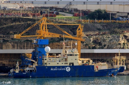
Vessel Peter Faber IMO: 8027781, MMSI: 228308600 Cable Layer
UTC, -32.01732, 115.66636, course: -1, speed: 1.1
UTC, -32.01734, 115.66628, course: -1, speed: 0.5
2026-01-26 15:31:22 UTC, -32.01722, 115.66531, course: -1, speed: 1.1
Live AIS position:
UTC. Near Fremantle),
updated 2026-01-26 15:31:22 UTC.
Find the position of the vessel Peter Faber on the map. The latter are known coordinates and path.
marine traffic ship tracker show on live map
The current position of vessel Peter Faber is -32.01722 lat / 115.66531 lng. Updated: 2026-01-26 15:31:22 UTCCurrently sailing under the flag of France
Peter Faber built in 1982 year
Deadweight:
2200 tDetails:
Last coordinates of the vessel:
UTC, -32.01739, 115.66640, course: -1, speed: 1UTC, -32.01732, 115.66636, course: -1, speed: 1.1
UTC, -32.01734, 115.66628, course: -1, speed: 0.5
2026-01-26 15:31:22 UTC, -32.01722, 115.66531, course: -1, speed: 1.1