 vesseltracker.com
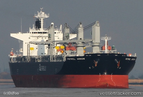
Vessel Petrel Arrow IMO: 9607083, MMSI: 311000114 Multi Purpose Carrier
UTC, 1.45333, 88.42333, course: -1, speed: 9
UTC, 1.63833, 88.67333, course: -1, speed: 10
2026-01-26 17:48:31 UTC, 1.85167, 88.96167, course: -1, speed: 9
Live AIS position:
UTC. 322 nm SE of Abakaliki),
updated 2026-01-26 17:48:31 UTC.
Find the position of the vessel Petrel Arrow on the map. The latter are known coordinates and path.
marine traffic ship tracker show on live map
The current position of vessel Petrel Arrow is 1.85167 lat / 88.96167 lng. Updated: 2026-01-26 17:48:31 UTCDetails:
Last coordinates of the vessel:
UTC, 1.30667, 88.24667, course: -1, speed: 9UTC, 1.45333, 88.42333, course: -1, speed: 9
UTC, 1.63833, 88.67333, course: -1, speed: 10
2026-01-26 17:48:31 UTC, 1.85167, 88.96167, course: -1, speed: 9