 vesseltracker.com
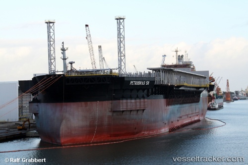
Vessel Petrobras 58 IMO: 9012238, MMSI: 538003137 Fpso Tanker
UTC, -21.21405, -39.99737, course: -1, speed: 0
UTC, -21.21406, -39.99736, course: -1, speed: 0
2026-01-26 17:31:29 UTC, -21.21406, -39.99728, course: -1, speed: 0.1
Live AIS position:
UTC. Near Capixaba FPSO),
updated 2026-01-26 17:31:29 UTC.
Find the position of the vessel Petrobras 58 on the map. The latter are known coordinates and path.
marine traffic ship tracker show on live map
The current position of vessel Petrobras 58 is -21.21406 lat / -39.99728 lng. Updated: 2026-01-26 17:31:29 UTCDetails:
Last coordinates of the vessel:
UTC, -21.21400, -39.99735, course: -1, speed: 0UTC, -21.21405, -39.99737, course: -1, speed: 0
UTC, -21.21406, -39.99736, course: -1, speed: 0
2026-01-26 17:31:29 UTC, -21.21406, -39.99728, course: -1, speed: 0.1