 vesseltracker.com
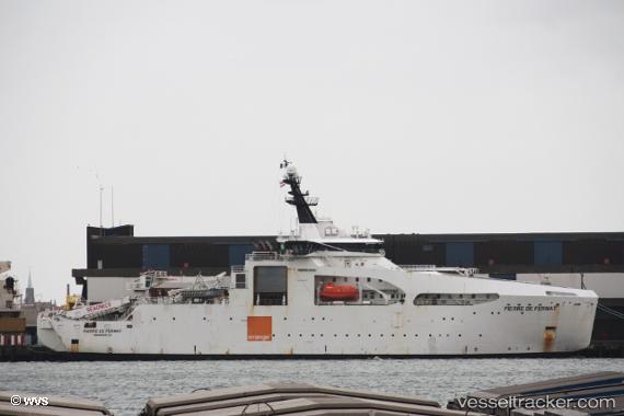
Vessel Pierre De Fermat IMO: 9694505, MMSI: 228041600 Cable Layer
UTC, 51.37024, 2.00897, course: 210, speed: 0.4
UTC, 51.37633, 2.00770, course: 215, speed: 0.2
2026-01-28 10:10:21 UTC, 51.37631, 2.00442, course: 215, speed: 0.1
Live AIS position:
UTC. 22 nm E of Broadstairs),
updated 2026-01-28 10:10:21 UTC.
Find the position of the vessel Pierre De Fermat on the map. The latter are known coordinates and path.
marine traffic ship tracker show on live map
The current position of vessel Pierre De Fermat is 51.37631 lat / 2.00442 lng. Updated: 2026-01-28 10:10:21 UTCCurrently sailing under the flag of France
Details:
Last coordinates of the vessel:
UTC, 51.37572, 2.00854, course: 209, speed: 0.1UTC, 51.37024, 2.00897, course: 210, speed: 0.4
UTC, 51.37633, 2.00770, course: 215, speed: 0.2
2026-01-28 10:10:21 UTC, 51.37631, 2.00442, course: 215, speed: 0.1