 vesseltracker.com
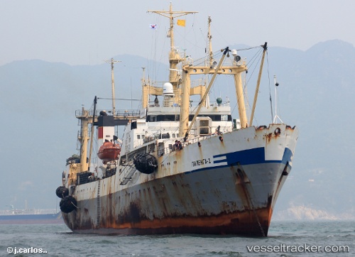
Vessel Pilenga 2 IMO: 9120310, MMSI: 273896300 Fishing Vessel
UTC, 53.25222, 160.74702, course: 218, speed: 11.4
UTC, 52.90092, 160.36832, course: 223, speed: 11.1
2026-02-01 15:41:27 UTC, 52.58923, 159.85023, course: 223, speed: 11.6
Live AIS position:
UTC. 51 nm SE of Petropavlovsk-Kamchatskiy),
updated 2026-02-01 15:41:27 UTC.
Find the position of the vessel Pilenga 2 on the map. The latter are known coordinates and path.
marine traffic ship tracker show on live map
The current position of vessel Pilenga 2 is 52.58923 lat / 159.85023 lng. Updated: 2026-02-01 15:41:27 UTCCurrently sailing under the flag of Russia
Pilenga 2 built in 1995 year
Deadweight:
1810 tDetails:
Last coordinates of the vessel:
UTC, 53.48803, 161.06723, course: 220, speed: 11.1UTC, 53.25222, 160.74702, course: 218, speed: 11.4
UTC, 52.90092, 160.36832, course: 223, speed: 11.1
2026-02-01 15:41:27 UTC, 52.58923, 159.85023, course: 223, speed: 11.6