 vesseltracker.com
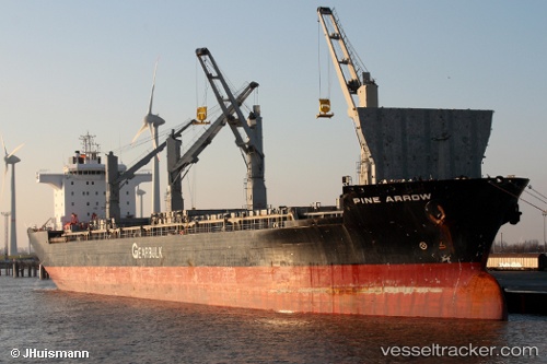
Vessel Pine Arrow IMO: 9107306, MMSI: 309587000 Multi Purpose Carrier
UTC, 31.36034, 121.63365, course: 117, speed: 9.8
UTC, 31.26714, 121.86645, course: 101, speed: 11.5
2026-01-29 17:59:41 UTC, 31.09857, 122.37664, course: 85, speed: 9.4
Live AIS position:
UTC. Near Jingjiang),
updated 2026-01-29 17:59:41 UTC.
Find the position of the vessel Pine Arrow on the map. The latter are known coordinates and path.
marine traffic ship tracker show on live map
The current position of vessel Pine Arrow is 31.09857 lat / 122.37664 lng. Updated: 2026-01-29 17:59:41 UTCCurrently sailing under the flag of Bahamas
Pine Arrow built in 1996 year
Deadweight:
48041 tDetails:
Last coordinates of the vessel:
UTC, 31.57615, 121.30378, course: 145, speed: 9.7UTC, 31.36034, 121.63365, course: 117, speed: 9.8
UTC, 31.26714, 121.86645, course: 101, speed: 11.5
2026-01-29 17:59:41 UTC, 31.09857, 122.37664, course: 85, speed: 9.4