 vesseltracker.com
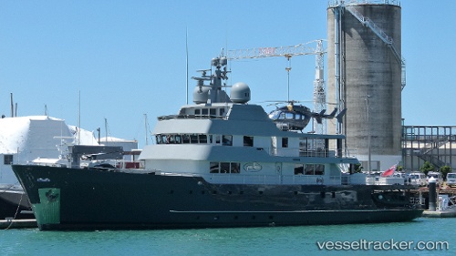
Vessel Plan B IMO: 1007914, MMSI: 319075000 Yacht
UTC, -40.62300, 176.61536, course: 31, speed: 9.7
UTC, -40.33500, 176.89833, course: -1, speed: 9
2026-02-01 01:34:37 UTC, -40.08333, 177.16667, course: -1, speed: 9
Live AIS position:
UTC. 28 nm E of Waipukurau),
updated 2026-02-01 01:34:37 UTC.
Find the position of the vessel Plan B on the map. The latter are known coordinates and path.
marine traffic ship tracker show on live map
The current position of vessel Plan B is -40.08333 lat / 177.16667 lng. Updated: 2026-02-01 01:34:37 UTCCurrently sailing under the flag of Cayman Is
Plan B built in 1973 year
Deadweight:
850 tDetails:
Last coordinates of the vessel:
UTC, -41.51905, 174.86768, course: 116, speed: 10.7UTC, -40.62300, 176.61536, course: 31, speed: 9.7
UTC, -40.33500, 176.89833, course: -1, speed: 9
2026-02-01 01:34:37 UTC, -40.08333, 177.16667, course: -1, speed: 9