 vesseltracker.com
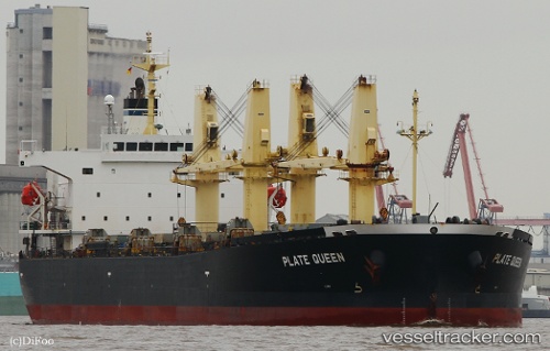
Vessel Plate Queen IMO: 9371074, MMSI: 538005164 Bulk Carrier
UTC, 29.39403, -89.59628, course: 328, speed: 10
UTC, 29.60156, -89.84920, course: 282, speed: 8.2
2026-01-31 08:20:18 UTC, 29.79742, -90.01098, course: 22, speed: 0
Live AIS position:
UTC. Near Wills Point),
updated 2026-01-31 08:20:18 UTC.
Find the position of the vessel Plate Queen on the map. The latter are known coordinates and path.
marine traffic ship tracker show on live map
The current position of vessel Plate Queen is 29.79742 lat / -90.01098 lng. Updated: 2026-01-31 08:20:18 UTCCurrently sailing under the flag of Marshall Is
Plate Queen built in 2007 year
Deadweight:
55649 tDetails:
Last coordinates of the vessel:
UTC, 29.31558, -89.37870, course: 323, speed: 9.6UTC, 29.39403, -89.59628, course: 328, speed: 10
UTC, 29.60156, -89.84920, course: 282, speed: 8.2
2026-01-31 08:20:18 UTC, 29.79742, -90.01098, course: 22, speed: 0