 vesseltracker.com
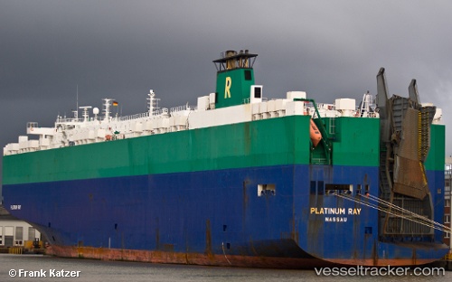
Vessel Platinum Ray IMO: 9210438, MMSI: 308726000 Vehicles Carrier
UTC, 20.24167, -106.92024, course: 303, speed: 15.6
UTC, 20.50667, -107.35667, course: -1, speed: 15
2026-01-30 23:28:15 UTC, 20.69609, -107.68226, course: 305, speed: 15.7
Live AIS position:
UTC. 86 nm SW of Nayarit),
updated 2026-01-30 23:28:15 UTC.
Find the position of the vessel Platinum Ray on the map. The latter are known coordinates and path.
marine traffic ship tracker show on live map
The current position of vessel Platinum Ray is 20.69609 lat / -107.68226 lng. Updated: 2026-01-30 23:28:15 UTCDetails:
Last coordinates of the vessel:
UTC, 19.97741, -106.46480, course: 304, speed: 15.2UTC, 20.24167, -106.92024, course: 303, speed: 15.6
UTC, 20.50667, -107.35667, course: -1, speed: 15
2026-01-30 23:28:15 UTC, 20.69609, -107.68226, course: 305, speed: 15.7