 vesseltracker.com
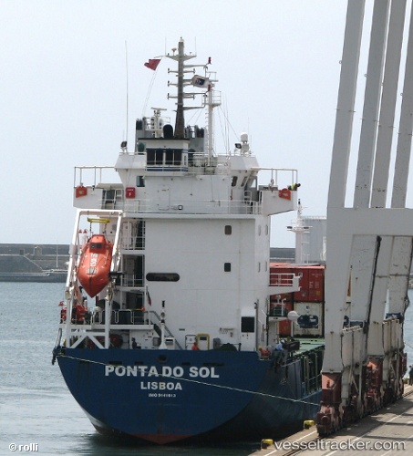
Vessel Ponta Do Sol IMO: 9141613, MMSI: 255806012 Multi Purpose Carrier
Live AIS position:
UTC. 330 nm NE of Santa Rita),
updated 2025-12-30 16:55:49 UTC.
Find the position of the vessel Ponta Do Sol on the map. The latter are known coordinates and path.
marine traffic ship tracker show on live map
The current position of vessel Ponta Do Sol is 15.66908 lat / -139.50941 lng. Updated: 2025-12-30 16:55:49 UTCCurrently sailing under the flag of Portugal
Ponta Do Sol built in 1997 year
Deadweight:
5184 tDetails:
Last coordinates of the vessel:
2025-12-30 16:55:49 UTC, 15.66908, -139.50941, course: -1, speed: 67.1