 vesseltracker.com
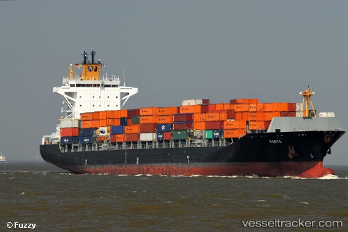
Vessel Porto IMO: 9481520, MMSI: 636091916 Container Ship
UTC, 25.59507, 120.27101, course: 219, speed: 13.8
UTC, 25.10213, 119.89106, course: 235, speed: 13.4
2026-02-01 16:19:23 UTC, 24.83854, 119.53682, course: 235, speed: 14.2
Live AIS position:
UTC. 21 nm S of Damaiyu),
updated 2026-02-01 16:19:23 UTC.
Find the position of the vessel Porto on the map. The latter are known coordinates and path.
marine traffic ship tracker show on live map
The current position of vessel Porto is 24.83854 lat / 119.53682 lng. Updated: 2026-02-01 16:19:23 UTCCurrently sailing under the flag of Liberia
Porto built in 2010 year
Deadweight:
39267 tDetails:
Last coordinates of the vessel:
UTC, 26.06277, 120.59982, course: 225, speed: 14.5UTC, 25.59507, 120.27101, course: 219, speed: 13.8
UTC, 25.10213, 119.89106, course: 235, speed: 13.4
2026-02-01 16:19:23 UTC, 24.83854, 119.53682, course: 235, speed: 14.2