 vesseltracker.com
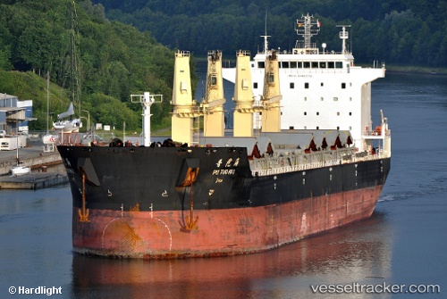
Vessel Pu Tuo Hai IMO: 9466518, MMSI: 413324000 Bulk Carrier
UTC, 21.95078, 113.20823, course: 38, speed: 0
UTC, 21.95082, 113.20830, course: 39, speed: 0
2026-02-04 13:45:25 UTC, 21.95103, 113.20835, course: 39, speed: 0
Live AIS position:
UTC. Near ZHUHAI),
updated 2026-02-04 13:45:25 UTC.
Find the position of the vessel Pu Tuo Hai on the map. The latter are known coordinates and path.
marine traffic ship tracker show on live map
The current position of vessel Pu Tuo Hai is 21.95103 lat / 113.20835 lng. Updated: 2026-02-04 13:45:25 UTCCurrently sailing under the flag of China
Pu Tuo Hai built in 2007 year
Deadweight:
53393 tDetails:
Last coordinates of the vessel:
UTC, 21.95078, 113.20832, course: 38, speed: 0UTC, 21.95078, 113.20823, course: 38, speed: 0
UTC, 21.95082, 113.20830, course: 39, speed: 0
2026-02-04 13:45:25 UTC, 21.95103, 113.20835, course: 39, speed: 0