 vesseltracker.com
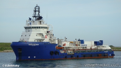
Vessel Punta Delgada IMO: 9507037, MMSI: 345010063 Offshore Tug Supply Ship
UTC, 19.57333, -92.21167, course: -1, speed: 2
UTC, 19.57667, -92.20833, course: -1, speed: 3
2026-02-05 05:16:32 UTC, 19.59227, -92.19437, course: 333, speed: 0.1
Live AIS position:
UTC. Near Yùum K'Ak'Náab),
updated 2026-02-05 05:16:32 UTC.
Find the position of the vessel Punta Delgada on the map. The latter are known coordinates and path.
marine traffic ship tracker show on live map
The current position of vessel Punta Delgada is 19.59227 lat / -92.19437 lng. Updated: 2026-02-05 05:16:32 UTCDetails:
Last coordinates of the vessel:
UTC, 19.52183, -92.18542, course: 44, speed: 0.1UTC, 19.57333, -92.21167, course: -1, speed: 2
UTC, 19.57667, -92.20833, course: -1, speed: 3
2026-02-05 05:16:32 UTC, 19.59227, -92.19437, course: 333, speed: 0.1