 vesseltracker.com
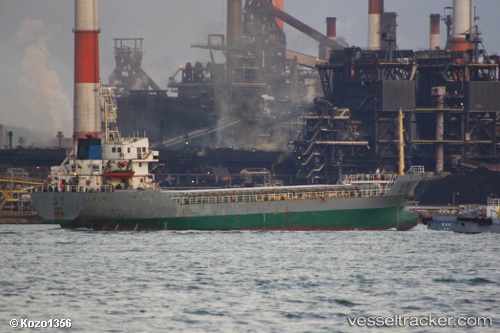
Vessel SEA LORD IMO: 9281413, MMSI: 620999497 Bulk Carrier
UTC, -33.79874, 25.68689, course: -1, speed: 0
UTC, -33.79874, 25.68688, course: -1, speed: 0
2026-03-15 19:59:26 UTC, -33.79872, 25.68687, course: -1, speed: 0
Live Vessel SEA LORD Analytics (details, animations, etc.)
Live AIS position: UTC. Near COEGA), updated 2026-03-15 19:59:26 UTC.Find the position of the vessel SEA LORD on the map. The latter are known coordinates and path.
marine traffic ship tracker show on live map
The current position of vessel SEA LORD is -33.79872 lat / 25.68687 lng. Updated: 2026-03-15 19:59:26 UTCCurrently sailing under the flag of Comoros
Details:
Last coordinates of the vessel:
UTC, -33.79874, 25.68686, course: -1, speed: 0UTC, -33.79874, 25.68689, course: -1, speed: 0
UTC, -33.79874, 25.68688, course: -1, speed: 0
2026-03-15 19:59:26 UTC, -33.79872, 25.68687, course: -1, speed: 0