 vesseltracker.com
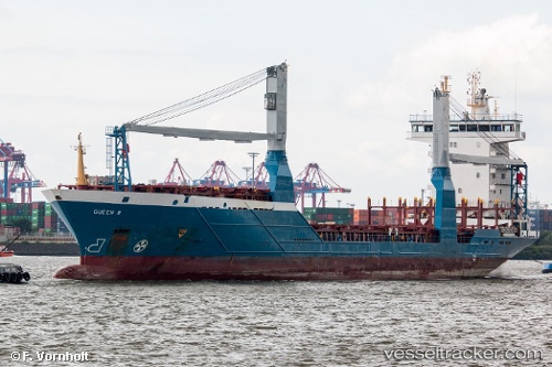
Vessel Queen B IMO: 9318929, MMSI: 212960000 Container Ship
UTC, 27.63044, -82.56366, course: 352, speed: 0
UTC, 27.63044, -82.56366, course: 352, speed: 0
2026-02-25 13:30:46 UTC, 27.63044, -82.56367, course: 352, speed: 0
Live AIS position:
UTC. Near Port Manatee),
updated 2026-02-25 13:30:46 UTC.
Find the position of the vessel Queen B on the map. The latter are known coordinates and path.
marine traffic ship tracker show on live map
The current position of vessel Queen B is 27.63044 lat / -82.56367 lng. Updated: 2026-02-25 13:30:46 UTCCurrently sailing under the flag of Cyprus
Queen B built in 2004 year
Deadweight:
8223 tDetails:
Last coordinates of the vessel:
UTC, 27.63044, -82.56366, course: 352, speed: 0UTC, 27.63044, -82.56366, course: 352, speed: 0
UTC, 27.63044, -82.56366, course: 352, speed: 0
2026-02-25 13:30:46 UTC, 27.63044, -82.56367, course: 352, speed: 0