
.

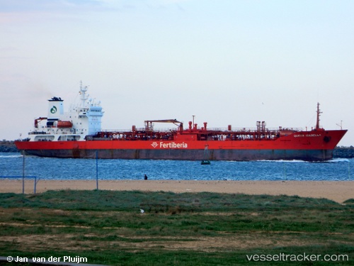
LR flag Queen Isabella

Vessel type: Lpg Tanker | IMO: 8908569 | MMSI: MMSI: 636090959
Call sign: A8IE2 | Dimensions: 131 m x 20 m
Current Status

Where is the vessel?

Queen Isabella is currently in 93 nm S of Adrar, based on AIS data received about 896d ago.

Latest AIS update:

Current position: 26.43357° N, 0.35241° E (93 nm S of Adrar)

Average speed (last 7 days): Loading…

Average speed (last 30 days): Loading…

Vessel profile: Queen Isabella is a Lpg Tanker with dimensions 131m x 20m.

This page combines live AIS, route history, probable destination signals, nearby traffic, and port activity for practical vessel monitoring.

The current position of vessel Queen Isabella is 26.43357 lat / 0.35241 lng. Updated: 2024-02-29 03:33:41 UTC
No newer position is currently available
Free positions are delayed by 14 hours.

No newer position is currently available. Please check again later.

Currently sailing under the flag of Liberia LR flag

Queen Isabella built in 1996 year

Deadweight:
12217 t

Details:

Live Vessel Queen Isabella Analytics (details, animations, etc.)


Recent AIS points (UTC):
2024-02-29 03:33:41 UTC · 26.43357, 0.35241 · SOG 0 kn · COG 315°

Track of the vessel in the last 60 days


UTC: --
Start: -- Track timeline (UTC) End: --
Encountered: --


Link to the map:


Find another ship

Queen_Isabella (636090959) last ports (portcalls and passsages)