 vesseltracker.com
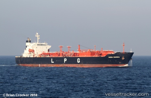
Vessel QUEEN ZENOBIA IMO: 9256535, MMSI: 636092988 LPG Tanker
UTC, 9.56587, -79.87894, course: 200, speed: 11
UTC, 9.44152, -79.96513, course: 359, speed: 0.1
2026-03-17 03:24:39 UTC, 9.44158, -79.96460, course: 341, speed: 0.1
Live Vessel QUEEN ZENOBIA Analytics (details, animations, etc.)
Live AIS position: UTC. Near Colon), updated 2026-03-17 03:24:39 UTC.Find the position of the vessel QUEEN ZENOBIA on the map. The latter are known coordinates and path.
marine traffic ship tracker show on live map
The current position of vessel QUEEN ZENOBIA is 9.44158 lat / -79.96460 lng. Updated: 2026-03-17 03:24:39 UTCCurrently sailing under the flag of Liberia
QUEEN ZENOBIA built in 2002 year
Deadweight:
19621 tDetails:
Last coordinates of the vessel:
UTC, 9.79913, -79.75629, course: 222, speed: 11.1UTC, 9.56587, -79.87894, course: 200, speed: 11
UTC, 9.44152, -79.96513, course: 359, speed: 0.1
2026-03-17 03:24:39 UTC, 9.44158, -79.96460, course: 341, speed: 0.1