 vesseltracker.com
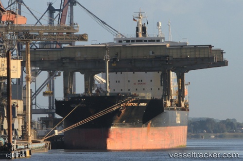
Vessel Quetzal Arrow IMO: 9007544, MMSI: 311044500 General Cargo Ship
UTC, 18.71599, -20.59138, course: 26, speed: 10.7
UTC, 18.96167, -20.45384, course: 28, speed: 10.4
2026-02-28 11:29:56 UTC, 19.25167, -20.28833, course: -1, speed: 10
Live AIS position:
UTC. 201 nm SW of Port Etienne),
updated 2026-02-28 11:29:56 UTC.
Find the position of the vessel Quetzal Arrow on the map. The latter are known coordinates and path.
marine traffic ship tracker show on live map
The current position of vessel Quetzal Arrow is 19.25167 lat / -20.28833 lng. Updated: 2026-02-28 11:29:56 UTCCurrently sailing under the flag of Bahamas
Quetzal Arrow built in 1992 year
Deadweight:
46908 tDetails:
Last coordinates of the vessel:
UTC, 18.47656, -20.73533, course: 26, speed: 10.5UTC, 18.71599, -20.59138, course: 26, speed: 10.7
UTC, 18.96167, -20.45384, course: 28, speed: 10.4
2026-02-28 11:29:56 UTC, 19.25167, -20.28833, course: -1, speed: 10