 vesseltracker.com
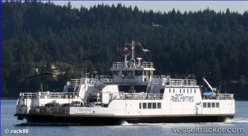
Vessel Quinitsa IMO: 7710965, MMSI: 316001265 Passenger Ro Ro Cargo Ship
UTC, 49.53518, -124.82438, course: 130, speed: 0
UTC, 49.53517, -124.82441, course: 126, speed: 0
2026-03-17 03:40:04 UTC, 49.53518, -124.82438, course: 129, speed: 0
Live Vessel Quinitsa Analytics (details, animations, etc.)
Live AIS position: UTC. Near Denman Island), updated 2026-03-17 03:40:04 UTC.Find the position of the vessel Quinitsa on the map. The latter are known coordinates and path.
marine traffic ship tracker show on live map
The current position of vessel Quinitsa is 49.53518 lat / -124.82438 lng. Updated: 2026-03-17 03:40:04 UTCCurrently sailing under the flag of Canada
Details:
Last coordinates of the vessel:
UTC, 49.53519, -124.82438, course: 130, speed: 0.1UTC, 49.53518, -124.82438, course: 130, speed: 0
UTC, 49.53517, -124.82441, course: 126, speed: 0
2026-03-17 03:40:04 UTC, 49.53518, -124.82438, course: 129, speed: 0