 vesseltracker.com
Find the position of the vessel Ramanda on the map. The latter are known coordinates and path.
marine traffic ship tracker show on live map
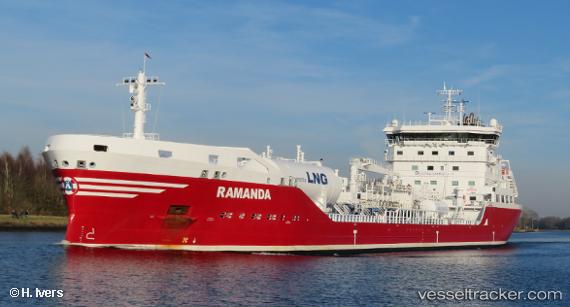
The current position of vessel Ramanda is 51.3188 lat / 4.31645 lng. Updated: 2024-11-24 04:37:06 UTCCurrently sailing under the flag of Sweden
Port of registry:
Donsö (urban area in Gothenburg Municipality, Sweden)Payload_mass:
16300 tonneGross tonnage:
12595Beam:
23 metreService entry:
2018-01-01T00:00:00ZManufacturer:
AVIC Dingheng Shipbuilding (shipyard in China)Details:
Last coordinates of the vessel:
UTC, 51.3187, 4.31643, course: 335, speed: 0UTC, 51.3187, 4.31639, course: 335, speed: 0
UTC, 51.3188, 4.31637, course: 335, speed: 0
2024-11-24 04:37:06 UTC, 51.3188, 4.31645, course: 335, speed: 0