vessel '636020477' IMO: 9609158, vesseltracker.com
Vessel '636020477' IMO: 9609158,
MMSI: 636020477 callsign: size: x

Find the position of the vessel '636020477' on the map. The latter are known coordinates and path.

marine traffic ship tracker show on live map

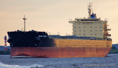
The current position of vessel '636020477' is 40.9786 lat / 28.9566 lng. Updated: 2024-05-07 22:32:36 UTC
Payload_mass:
81623 tonne
Gross tonnage:
45271
Service entry:
2012-01-01T00:00:00Z
Details:


Last coordinates of the vessel:
UTC, 40.9784, 28.9566, course: 300, speed: 0
UTC, 40.9786, 28.9566, course: 293, speed: 0
UTC, 40.9787, 28.9567, course: 291, speed: 0
2024-05-07 22:32:36 UTC, 40.9786, 28.9566, course: 296, speed: 0

Track of the vessel in the last 14 days


Most frequent ports a vessels calls at '636020477' (636020477):

Bandar Khomeini, traffic: 6
Paranagua, traffic: 2
Kandla, traffic: 2
Madras, traffic: 2
Panamburu, traffic: 1
Ras Gharib, traffic: 1
Bur Ibrahim, traffic: 1
Ra’S Shukhayr, traffic: 1
Fujairah, traffic: 1
Uskudar, traffic: 1
Gelibolu, traffic: 1
Port Elizabeth, traffic: 1
Istanbul, traffic: 1
Mangalore, traffic: 1
New Mangalore, traffic: 1

Link to the map:


Find another ship

'636020477' (636020477) last ports (portcalls and passsages)

New Mangalore | 2024-01-07 06:23:49
Panamburu | 2024-01-05 18:08:39
Ra’S Shukhayr | 2023-12-25 02:24:16
Ras Gharib | 2023-12-25 01:10:54
Bur Ibrahim | 2023-12-24 15:46:23
Gelibolu | 2023-12-20 08:02:20
Uskudar | 2023-12-19 07:57:42
Fujairah | 2022-11-17 05:46:02
Bandar Khomeini | 2022-11-13 12:05:56
Bandar Khomeini | 2022-11-09 08:11:58
Paranagua | 2022-09-26 04:19:50
Paranagua | 2022-09-22 01:55:57
Bandar Khomeini | 2022-07-16 16:57:19
Bandar Khomeini | 2022-07-12 16:33:24
Port Elizabeth | 2022-04-13 21:25:06
Madras | 2022-03-25 06:17:16
Kandla | 2022-03-12 03:22:33
Bandar Khomeini | 2022-02-03 13:54:24