 vesseltracker.com
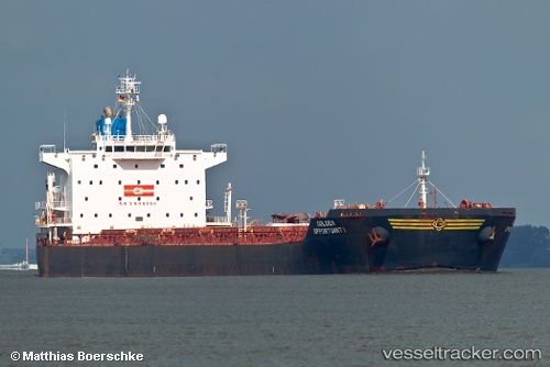
Vessel SANTA MARIA IMO: 9389813, MMSI: 636021257 Bulk Carrier
UTC, 52.22833, 145.96667, course: -1, speed: 12
UTC, 52.59167, 145.77499, course: -1, speed: 12
2026-03-04 15:04:01 UTC, 52.85333, 145.63333, course: -1, speed: 12
Live Vessel SANTA MARIA Analytics (details, animations, etc.)
Live AIS position: UTC. 101 nm SE of Okha), updated 2026-03-04 15:04:01 UTC.Find the position of the vessel SANTA MARIA on the map. The latter are known coordinates and path.
marine traffic ship tracker show on live map
The current position of vessel SANTA MARIA is 52.85333 lat / 145.63333 lng. Updated: 2026-03-04 15:04:01 UTCCurrently sailing under the flag of Liberia
SANTA MARIA built in 2008 year
Deadweight:
75825 tDetails:
Last coordinates of the vessel:
UTC, 51.78508, 146.19826, course: -1, speed: 12.3UTC, 52.22833, 145.96667, course: -1, speed: 12
UTC, 52.59167, 145.77499, course: -1, speed: 12
2026-03-04 15:04:01 UTC, 52.85333, 145.63333, course: -1, speed: 12