 vesseltracker.com
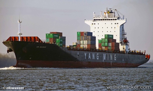
Vessel 'SYNERGY BUSAN' IMO: 9450571, MMSI: 538008755
UTC, 28.77667, 124.02333, course: -1, speed: 15
UTC, 29.20110, 124.42809, course: 37, speed: 15.5
2026-02-01 09:34:58 UTC, 29.58167, 124.72667, course: -1, speed: 15
Live AIS position:
UTC. 132 nm SE of Lü-hua Shan),
updated 2026-02-01 09:34:58 UTC.
Find the position of the vessel 'SYNERGY BUSAN' on the map. The latter are known coordinates and path.
marine traffic ship tracker show on live map
The current position of vessel 'SYNERGY BUSAN' is 29.58167 lat / 124.72667 lng. Updated: 2026-02-01 09:34:58 UTCDetails:
Last coordinates of the vessel:
UTC, 28.32667, 123.54333, course: -1, speed: 16UTC, 28.77667, 124.02333, course: -1, speed: 15
UTC, 29.20110, 124.42809, course: 37, speed: 15.5
2026-02-01 09:34:58 UTC, 29.58167, 124.72667, course: -1, speed: 15