 vesseltracker.com
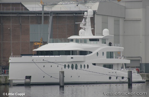
Vessel SEA & US IMO: 1012880, MMSI: 533132409 Houseboat
UTC, 40.96191, 28.65623, course: 56, speed: 0
UTC, 40.96190, 28.65623, course: 57, speed: 0
2026-02-02 15:53:14 UTC, 40.96189, 28.65623, course: 56, speed: 0
Live AIS position:
UTC. Near Ambarli),
updated 2026-02-02 15:53:14 UTC.
Find the position of the vessel SEA & US on the map. The latter are known coordinates and path.
marine traffic ship tracker show on live map
The current position of vessel SEA & US is 40.96189 lat / 28.65623 lng. Updated: 2026-02-02 15:53:14 UTCCurrently sailing under the flag of Malaysia
SEA & US built in 2018 year
Deadweight:
254 tDetails:
Last coordinates of the vessel:
UTC, 40.96190, 28.65623, course: 56, speed: 0UTC, 40.96191, 28.65623, course: 56, speed: 0
UTC, 40.96190, 28.65623, course: 57, speed: 0
2026-02-02 15:53:14 UTC, 40.96189, 28.65623, course: 56, speed: 0