 vesseltracker.com
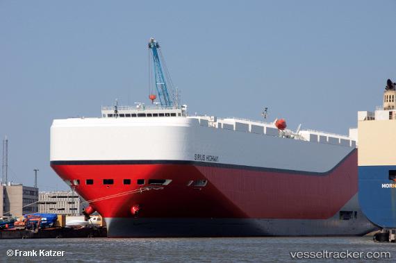
Find the position of the vessel Sirius Highway on the map. The latter are known coordinates and path.
marine traffic ship tracker show on live map
The current position of vessel Sirius Highway is 10.535 lat / 112.538 lng. Updated: 2025-06-05 18:16:37 UTCCurrently sailing under the flag of Marshall Is
Payload_mass:
20419 tonneGross tonnage:
75044Service entry:
2017-01-01T00:00:00ZManufacturer:
Shin Kurushima Dockyard (Japanese shipbuilding company)
Details:
Last coordinates of the vessel:
UTC, 11.0595, 113.112, course: 227, speed: 18.2UTC, 10.8905, 112.923, course: 227, speed: 17.9
UTC, 10.5758, 112.583, course: 228, speed: 17.7
2025-06-05 18:16:37 UTC, 10.535, 112.538, course: -1, speed: 17